This morning, the National Weather Service's Climate Prediction center issued their official U.S. Winter Outlook. The forecast calls for cooler than normal conditions in the northern states, and somewhat warmer than average temperatures in the southern states. Additionally, the outlook calls for above average precipitation in the north (especially over the northern Rockies) and less precipitation than usual across the southern third of the country.

Image courtesy: Climate Prediction Center

Image courtesy: Climate Prediction Center
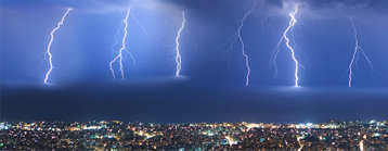
Within minutes of this forecast being published, a few media outlets began talking about the return of the "polar vortex" and the dramatic effect it will have on this winter's weather. Unfortunately, this isn't really all that accurate, because the polar vortex develops every winter. It is simply a persistent area of low pressure that forms over the Arctic. Occasionally, strong mid-latitude storm systems can pull this low pressure system -- and its associated cold air -- south into the northern US. This is known as a "polar vortex event," but this is a short-term event. It's not the sort of thing that can affect the entire winter forecast. The image below shows how this situation develops.

Image courtesy: NASA
It's All About The Oscillations
So, if not the dreaded polar vortex, what is to blame for the colder and snowier winter we're likely to see in the northern U.S.? There are two main factors meteorologists look at when determining the winter outlook: The El Niño/Southern Oscillation, and the Arctic Oscillation. These features give us clues as to how the weather will behave over several months. You may remember that we wrote about the El Niño/Southern Oscillation last year, when a strong El Niño was in effect. This year, instead of an El Niño, we expect a La Niña to develop. That is, Pacific Ocean temperautres off the coast of Central America will be cooler than normal.
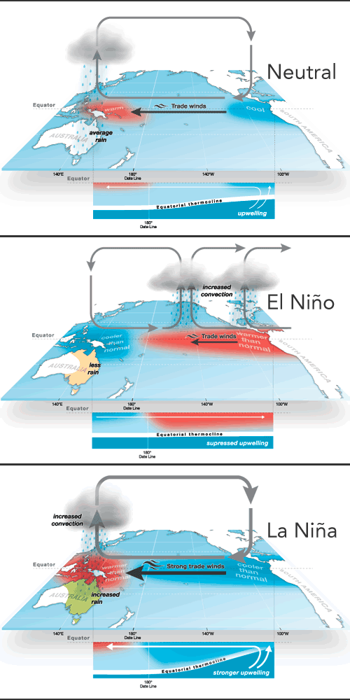
Image Courtesy Columbia University
Generally speaking, a La Niña event leads to cooler temperatures and more precipitation over the northern U.S., and warmer, drier conditions across the southern states, and that's exactly what we see in the Weather Service's outlook. However, this La Niña is expected to be somewhat weaker than recent events, and to deminish a bit as we head into the mid-late winter months. This means that, while it will likely be colder and snowier in the north, conditions might not be quite as severe as the most recent La Niña winters, 2010-11 and 2011-12, which saw record cold and snowfall in many locations.
This prediction is supported by the second oscillation that meteorologists watch, the Arctic Oscillation Index. This is a measurement of general surface pressure trends in the Arctic region. A negative Arctic Oscillation tends to favor more frequent surges of cold air from the polar region into the middle latitudes, due to disruptions in the jet stream.
As the chart below indicates, the Arctic Oscillation is negative but trending back towards neutral, and may even turn positive as we head into the winter. This suggests that conditions might not be quite as harsh across the northern states as they would be during a typical La Niña winter.
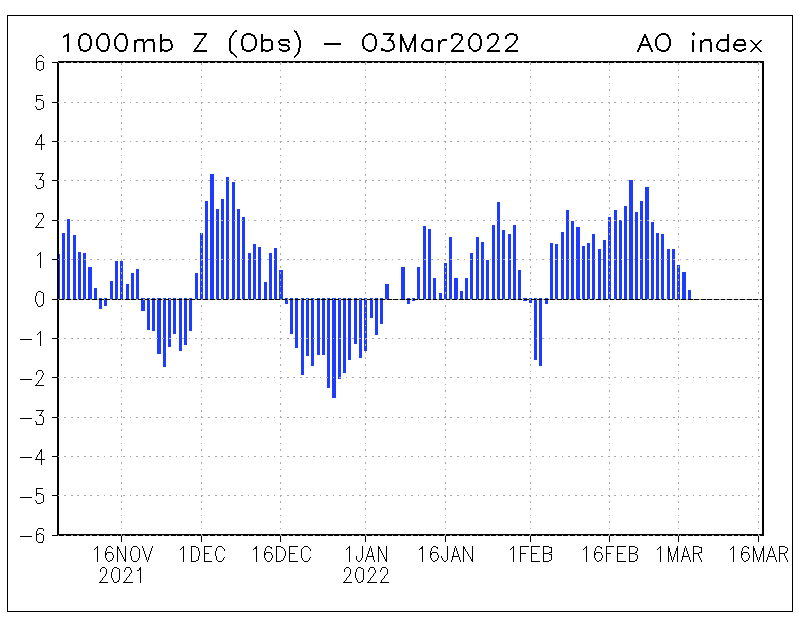
Image courtesy: Climate Prediction Center
The Bottom Line
It's important to remember that while these factors suggest an overall trend, they don't allow us to pinpoint individual storm systems or cold outbreaks. The key word here is trends. Areas expected to see above average temperatures overall will still have occasional cold snaps, and areas expecting below average precipitation will still see storms that bring rain, ice, or snow depending on the event. Knowing the overall trend can give you an idea of what the winter will be like as a whole, but it's essential to be prepared for inclement winter weather throughout the season, regardless of the long-range forecasts.