Meet the Meteorologist
What's your favorite weather phenomena?
What got you interested in the weather?


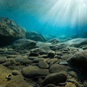
It’s the largest formation of its kind yet found on Earth; a huge expanse of relatively fresh water was recently discovered underneath the ocean floor, off the coast of the northeastern United States. Stretching from Massachusetts to New Jersey, this giant underground aquifer has enough water to fill a lake with an area of 15,000 square miles. A team lead by Chloe Gustafson of Columbia University’s Lamont-Doherty Earth Observatory used electromagnetic sensing equipment to map this previously poorly understood underground water resource.
Offshore drilling since the 1970s, off the coast of the Northeast, had previously hinted there was water of low salinity under the seafloor of the continental shelf. Subsequent drilling around the world has also revealed low-salinity water resources off the coast of the other continents. What differentiates this latest study is that we now have a more accurate map of the aquifer using electromagnetic (EM) sensing equipment, both passive and active. The passive system uses stationary sensors on the seafloor to measure how natural EM disturbances, like those from lightning strikes or solar wind, resonate through the different layers under the seafloor. At the same time, an active system called Controlled Source EM (CSEM) was towed behind a ship to emit EM waves, which were then measured by a receiver. Using the fact that saltwater is a better conductor of EM waves than freshwater, the team was able to effectively map the extent of the underground low-salinity aquifer. In their recent study, the team showed that the aquifer is largely continuous, extends out as much as 75 miles from the shore, and lies between 600 and 1,200 feet below the ocean floor. Furthermore, the water was shown to be the freshest near the shore (with around 1 part per thousand of salt). Further out, the salinity rises to 15 parts per thousand, which would require some desalinization for drinking purposes.
In the future, this same method of using EM sensing equipment may be utilized to map the subseafloor water resources around the world. These resources, if similar to the northeastern U.S. aquifer, could present a more economical source of freshwater with only mild desalinization required, compared to the more costly operation of seawater desalinization. However, further studies will need to be done to determine the environmental impact of tapping any of these undersea aquifers.


 Paul Trambley
 Derek Heit
 Jennifer Wojcicki
 Laura Lockwood
 Ray Miller


