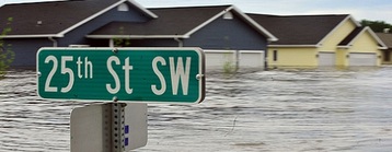
Severe winter weather continues for 2016 with blizzard conditions expected for portions of the Plains. However, this is a different kind of blizzard compared to what we usually see as the highest snowfall accumulations associated with this system will only be around 2-4 inches over the entire event. High wind speeds associated with this system will result in near whiteout conditions through the affected areas thanks to already existing snow on the ground plus the light accumulations that will precipitate through the event.
WHAT IS A BLIZZARD?
Before we dive into exactly what we can expect with this storm system, we should first look at what qualifies as a blizzard. According to the National Weather Service, a winter storm officially becomes a blizzard when the following two conditions occur for three hours or longer: sustained wind or frequent gusts of 35mph or greater along with falling snow and/or blowing snow reducing visibility to less than 1/4 mile. This means that the primary defining feature of a blizzard is the low visibility created by snow and/or blowing snow when combined with strong winds, not necessarily heavy snowfall amounts.
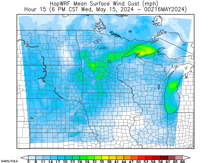
Wind gusts via the 09Z HOPWRF - 2/7/16 (Source)
BLIZZARD THREAT ALONG RED RIVER
The low pressure system will move into the northern Plains tonight bringing very strong winds both with wind gusts as high as 60mph and sustained winds easily above 35-40mph. This will be due to an area of high pressure over the Rockies creating a tight pressure gradient on the south and west portions of this low. The large change in pressure over such a small distance will create strong northwesterly winds across the Plains and even into the western portions of the Midwest. Existing snow along with precipitation from areas surrounding the Red River and stretching down into Northern Iowa will start getting blown around by the strong winds lowering visibility considerably. This threat remains limited to this particular region due to the path precipitation will take. Noticeable snowfall accumulations will only get as far west as eastern North Dakota / South Dakota while high wind speeds should only get as far east as southwestern Minnesota / central Iowa. Just east of the blizzard conditions, we can expect blowing snow to be not quite as prevalent, but still enough to spark a few winter weather advisories. Expect blizzard conditions to taper off by Monday.

12Z NAM Precipitation - 2/7/16 (Source)
HIGH WINDS IN THE PLAINS
Areas west of the blizzard threat are not going to remain calm by any means. Extremely strong wind speeds are expected in North Dakota, South Dakota, Montana, and Nebraska. There are already a number of advisories and warnings in effect for this region due to the winds. Wind gusts will be similar to those in areas with blizzard conditions; however blowing snow is not a significant concern due to a lack of precipitation over the last month and through the next few days. So while visibility will not be a major concern, high wind speeds will still result in hazardous travel conditions through the Plains and could damage property. In comparison to severe thunderstorms during the warmer months, a thunderstorm is classified as severe when wind gusts associated with the storm exceed 58mph. Wind gusts with this low may be as strong at 60mph.
As always, keep up to date with the latest advisory information via the Weatherology Advisory page and avoid travel during this event if at all possible if you're in the effected region.