Meet the Meteorologist
What's your favorite weather phenomena?
What got you interested in the weather?


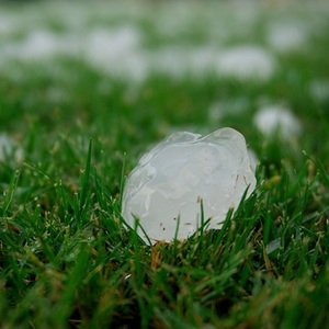
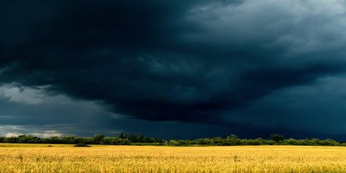
It's long been one of the more challenging aspects of severe weather forecasting. Predicting what storms will produce hail, and just how large that hail will grow, may soon get a technological boost from a seemingly unlikely source. The same type of artificial intelligence currently used in facial recognition systems, called a convolutional neural network, was recently deployed by researchers at the National Center for Atmospheric Research (NCAR) with the aim to improve hail forecasting.
As detailed in a previous article, for large hail to form the atmospheric environment needs to cool rapidly with height, the storm needs to have a strong updraft, and a freezing level relatively close to the ground. It also helps if the storm forms in an environment with high wind shear (winds at different speeds and directions at different altitudes). In that way, the storm's updraft and downdraft become separated from each other, won't interfere with each other, and provide a cyclical path through the thunderstorm allowing small ice pellets to grow into large hailstones.
However, two storms with these same ingredients can produce widely varying hail sizes due to the difference in the complex paths that the developing hailstones travel in the updrafts and downdrafts of each storm. That's where the neural network comes into play. At NCAR, this machine learning model was presented with images of simulated storms, along with values of temperature, wind speed, and pressure throughout the storm, as well as what size hail the simulated storms ended up producing. After analyzing multiple storms, the neural network was trained to recognize the shape of severe-hail-producing storms as well as the internal characteristics of these storms in three-dimensional space.
The next step will be to train this neural network with radar data and observations from actual storms and storm environments with the eventual goal of using this technology for forecasting on a more operational basis.


 Paul Trambley
 Derek Heit
 Jennifer Wojcicki
 Laura Lockwood
 Ray Miller


