Meet the Meteorologist
What's your favorite weather phenomena?
What got you interested in the weather?
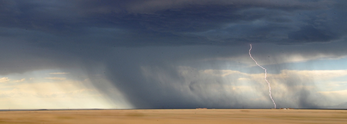

Each severe weather season, tornadoes, destructive hail, and straight-line winds wreak havoc across the U.S. All are dangerous, but of these, one is more likely to impact you than any other. This distinction belongs to straight-line winds. Straight-line winds are damaging winds that travel in a uniform direction as they propagate across an area. Some straight-line wind events can be so destructive that they are sometimes mistaken for tornadoes. However, there is a tell-tale sign that a damage path was caused by straight-line winds and not a tornado. When damaged trees and other structures are leaning in a uniform direction, the culprit is more than likely straight-line winds. On the other hand, tornadoes will inflict damage in paths that show its impact inflicted in varied directions due to the rotating winds found in a tornado. Straight-line winds can at times exceed 100 mph, while the winds in a tornado can top 200 mph. Tornadoes tend to keep their destruction confined to more localized areas, while straight-line winds tend to inflict damage on a much larger scale. For this reason, straight-line winds account for around 50% of all severe reports during any given year. Now that you know some of the statistics surrounding straight-line winds, let's dig into how this weather phenomenon forms.
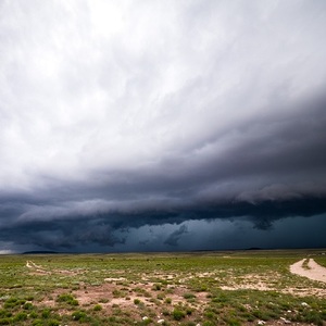
Understanding the basic anatomy of a thunderstorm and the vertical wind currents that occur within is integral in gaining an understanding of how straight-line winds develop. When a thunderstorm develops, a localized rising current of air, known as an updraft heads skyward. At this point, an observer would notice a growing cumulus cloud. When adequate moisture is present at the surface and a favorable environment exists higher in the atmosphere, the cloud updraft will increase in velocity, and a towering cumulus cloud will be seen. As the thunderstorm matures, rain begins to fall to the ground. As the rain droplets fall, air is dragged downward with them. This downward directed current of air is known as a downdraft (the opposite direction of an updraft). Meanwhile, as the edges of the storm interact with dry air that is surrounding it, some raindrops evaporate. Because evaporation is a cooling process, the pocket of air where the raindrops have evaporated becomes cooler than the air surrounding it. Because cool air is more dense than warm air, this cooled pocket of air accelerates downward. It is these two processes that work together to create the downdraft portion of the storm. For a time the updraft and downdraft will co-exist in harmony, but at some point the updraft will get overtaken by the downdraft, and at that point the storm will fizzle out.
Now that you understand the basic structure of a thunderstorm, let's look at how this relates to the formation of straight-line winds. When the environment is favorable for strong thunderstorms, updraft and downdraft speeds can exceed 100 mph. Meanwhile, intense downdraft winds, also known as microbursts, drive down to the surface and then spread out. As the wind spreads out horizontally over the land, straight-line winds are experienced. The image below depicts this process as a microburst is shown accelerating to the ground and then spreading out horizontally, resulting in straight-line winds. As the wind travels across the surface it will at first be intense, but as it travels further, the effects of friction at the surface will slow it down. For this reason, damage from microbursts can be fairly localized at times. However, during favorable atmospheric conditions, organized storm complexes can produce straight-line winds for 100's of miles.
The safety protocol for straight-line winds is the same as you would follow for a tornado. This is because straight-line winds can uproot trees, toss various debris airborne, and cause damage to standing structures. For this reason, it is advised that you stay away from windows and go to the lowest level of a home or business. Always seek an interior room on the lowest level, which is typically a bathroom or hallway. If you have no access to a shelter, the best option is to seek an open area away from trees or other structures that may fall on you. So the next time you hear that straight-line winds are approaching, seek shelter and ride the storm out in safety.
For a visual on how a microburst can produce straight-line winds at the surface, click here.
https://www.weather.gov/images/bmx/Daily/microbursts/microburst.jpg


 Derek Heit
 Jennifer Wojcicki
 Laura Lockwood
 Ray Miller


