Meet the Meteorologist
What's your favorite weather phenomena?
What got you interested in the weather?

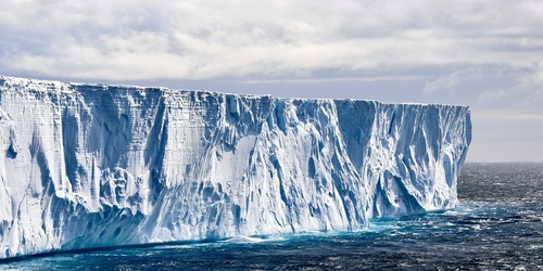
The term "blue norther" was likely first used by folks from the Texas and Oklahoma Panhandle regions during the late 1800's to early 1900's. Over time, this moniker gained popularity in being used to describe fast-moving cold fronts that brought dramatic temperature falls. Although the term was coined by residents in the southern Plains, these types of fronts can occur all the way eastward to the Atlantic Ocean. They are most common from November through April. The type of temperature falls you can expect when a blue norther passes through is more than 25 degrees in one hour, to around 50 degrees in 24 hours. Oftentimes, the cloud cover along the cold front in a blue norther has a bluish tint, and intense north winds can be expected as the front blows through. There have been some particularly extraordinary blue northers that left an indelible impression on those who lived through it. One of the most impressive blue northers in history hit the Plains region back on November 11th and 12th of 1911.
This historic event hit during a time when forecast models and weather satellites were not in existence. Thus, there was little to no warning that this major event was on its way for residents in the Plains. The beginnings of this blue norther occurred when a strong high pressure system developed over far northern Canada. The arctic high then intensified and drifted southward across Alberta on the 9th. The air mass that developed in the vicinity of this high was exceptionally bitter for early November. At the same time, a low pressure system began to strengthen across the eastern Rockies and moved into IA and MO on the 11th. As this system intensified, it drew unseasonably warm and humid conditions north from the Gulf of Mexico into the Plains. As the system trekked eastward, the arctic air in Canada came crashing southward in its wake. This made for some unusual occurrences for this time in the fall season. Parts of WI, IA, IL, and IN saw deadly tornadoes on the 11th. Janesville, WI saw the strongest tornado as an F4 touched down that night after 9pm, taking 9 lives with it. Only 1 hour after the tornado touchdown, the blue norther moved through and temperatures plummeted, while blizzard conditions developed.
As the fast-moving cold front accelerated southward across the nation's mid-section, areas across the central and southern Plains saw historic temperature falls that have still never been equaled. Many areas saw record highs and lows on the same day, and many of those records remain unbroken. This was the case for Columbia, MO, which saw a record high of 82 followed by a record low of 13 just before midnight. Some areas in MO that saw highs in the 70s that day actually received 1-2 inches of snow by the evening! Springfield, MO saw a 67 degree temperature fall in just 10 hours. In Chicago, the extreme temperature change proved deadly. A man in Chicago perished from heat stroke on the morning of the 11th, followed by another man freezing to death that night after taking a fall and being unable to get help.
Thanks to the advent of forecast models, intense fast-moving cold fronts can now be tracked days in advance. It is hard to imagine the shock that residents of the Plains experienced during the great blue norther of 1911. Its ferocity will likely never be matched as its records continue to stand the test of time.
 Derek Heit
 Jennifer Wojcicki
 Laura Lockwood
 Ray Miller