Meet the Meteorologist
What's your favorite weather phenomena?
What got you interested in the weather?

In the upper Midwest, folks are accustomed to hearing of 'Alberta Clippers' during the winter season. Beyond the brief mentions of these systems, no further explanation is given as to what an Alberta Clipper really is. Let's dig into where the term was derived from, while giving you a better understanding of what to expect when one heads your way.
Oftentimes, weather systems are named for the locations where they first develop. In this case, the Canadian province of Alberta is where most clipper low pressure systems form. But at times, these systems do originate further east in Saskatchawan, or even Manitoba. You may or may not have heard of the much less used naming convention for these systems. These systems can be referred to as 'Saskatchawan Screamers' or 'Manitoba Maulers,' which sound a bit more menacing than their Alberta cousin. In general, most systems that are born in any of the Canadian prairie provinces are simply dubbed, 'Alberta Clippers.' During certain jet stream patterns, Alberta Clipper lows can be very frequent occurrences across the northern Plains region. The ideal setup occurs when the polar jet stream builds northward into western Canada, and then dives southeastward into the Plains. At times, this type of pattern can continue for weeks on end, resulting in a succession of Clipper systems. The highest frequency of Alberta Clipper lows can be expected during the late fall and winter season, due to the tendency for the jet stream to dive southeast out of Canada during this period of the year.
Now to explain where the 'Clipper' portion of Alberta Clipper is referring to. During the mid-1800's, the fastest ship around was the clipper ship. The ship's dimensions were fairly long and narrow, so they could cut through the water better. They also took full advantage of harnessing the wind by employing many sails. Because of their speed, compared to previous vessels, they were widely used on the major trade routes around the world during that time.
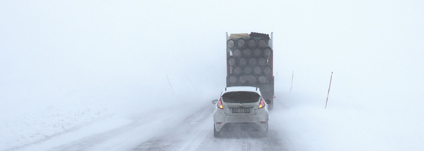
Now that you know where the 'Alberta' and 'Clipper' terms came from, you can decipher that these systems are fast moving lows that oftentimes originate in the Canadian province of Alberta. Due to their fast movement, Alberta Clippers tend to be short-lived, quick-hitting snowfall events. Because of this, snowfall amounts will most often stay at a few inches or less. Although high snow-liquid ratios (the amount of snowfall that piles up for every one inch of liquid water) are common during these events, which can bring snowfall amounts to several inches in certain instances. The last and most often troublesome aspect of Alberta Clipper lows is created by the gusty winds that occur in their wake. The strong winds can produce major travel problems, due to the visibility issues created by blowing snow. These gusty winds will also typically usher in severe arctic air masses, resulting in dangerously cold wind chills over the northern Plains.

 Derek Heit
 Jennifer Wojcicki
 Laura Lockwood
 Ray Miller