Tornado Alley Version 2.0
Michael Karow
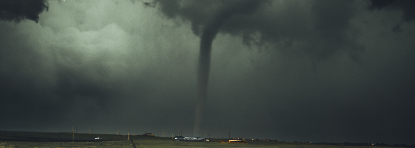
Tornado Alley, stretching across the Great Plains of the United States, sometimes including parts of the Midwest, is perhaps the most famous tornado-producing region in the world. With global climate change, though, the swath of Tornado Alley appears to be shifting.
In a 2018 study, researchers from Northern Illinois University and the National Severe Storms Laboratory have discovered that Tornado Alley is beginning to shift further east.
Looking at data from the period 1979-2017, the researchers compared the ingredients that spawn tornadoes (including atmospheric instability and wind shear) to actual reports of tornadoes. On average, they found that the frequency of tornado reports and tornado-conducive days is actually decreasing across a large part of the Great Plains. However, they also found that these same tornado parameters are increasing further to the east across the Mid-South, in a region known as Dixie Alley.
Tornado outbreaks have been particularly deadly in Dixie Alley in both the distant and recent past. Outbreaks such as the
1884 Enigma Outbreak,
1925 Tri-State Tornado outbreak, as well as the
2011 Super Outbreak have been some of the deadliest in U.S. history. The reason that Dixie Alley tornadoes often prove deadly is due to a combination of factors. First, the population density is higher in these states than in the Plains states, so any tornado that touches down has a higher likelihood of hitting a populated area. Second, hilly and tree-filled terrain can obscure the view of an approaching tornado. Third, tornado-producing storms often move at a faster forward speed in the southern United States, owing to a stronger jet stream. Finally, nocturnal tornadoes are more common in the Mid-South and Southeast than in points further northwest. Without a way to receive warnings at night (such as
NOAA Weather Radio or
Wireless Emergency Alerts), many people have been caught unaware of the approaching danger in the middle of the night.
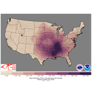
Mean number of days per decade with a significant tornado (EF2+) within 25 mi of a point (1986-2015) - NOAA/NWS SPC
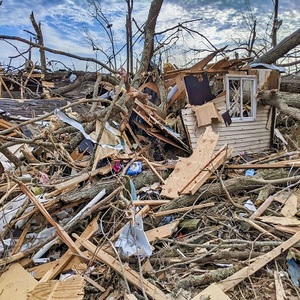
Damage to a home after a Dec. 2021 tornado in Cambridge Shores, KY
 Paul Trambley
 Derek Heit
 Jennifer Wojcicki
 Laura Lockwood
 Ray Miller