Meet the Meteorologist
What's your favorite weather phenomena?
What got you interested in the weather?

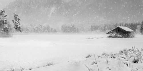
Widespread precipitation affects parts of the country the next few days with several inches of snow, rain, and severe weather all expected.
The first system will move out of CO early today and move east through KS today, turns northeast making it to Lake Michigan by Saturday morning, and finally heads through eastern Canada throughout Saturday. On the northwest side of this system, several inches of snow is likely from Northern NE/Southern SD east-northeastward to the UP of MI with some picking up a foot or more before ending. On the northeastern part of this system, soaking rains are expected with a brief changeover to snow before coming to an end. Finally, on the southern part of this system near a cold front will be scattered showers and storms with some severe storms possible. Severe storms are possible from southeast TX northeastward to the southern part of the Chicago metro area with the greatest threat coming from Central IL/SW IN to eastern AR/Northwest MS. The main severe threat will be damaging winds and tornadoes with some hail potential initially in Southeast MO, Southwest IL, and Northeast AR with the majority of this activity coming after dark.
The other system will affect the Northwest through much of the weekend with precipitation as far east as Northwest WY and as far south as Northern CA.


 Paul Trambley
 Derek Heit
 Jennifer Wojcicki
 Laura Lockwood
 Ray Miller


